Cedar City sits smack in the middle of some of the most jaw-dropping scenery in Utah. Getting out for a hike is a great way to throw yourself right in the midst of it—but your own two feet can only carry you so far. The solution? Take the scenic route!
Set some time aside to take in the landscapes from the comfort of your own car by taking one of the area’s many officially designated scenic byways. From a drive that peeks into a geologic amphitheater more than 2,000 feet deep to a highway that cuts through crimson-colored cliffs, to a route that connects several of Utah’s famous national parks, here are some of our favorites. Now let’s hit the road!
Markagunt High Plateau Scenic Byway
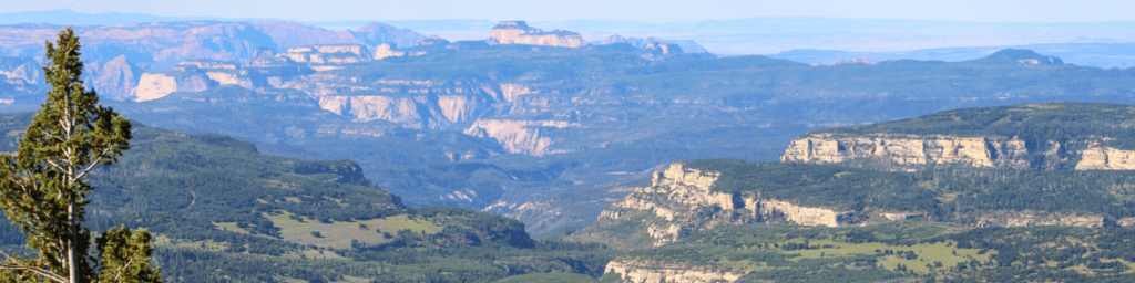
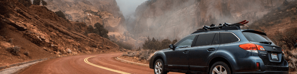
Cedar Canyon , Hwy 14
State Route 14 begins in the heart of Cedar City and continues for 40 miles to where it intersects with Highway 89 at Long Valley Junction. It makes a steep, winding climb through cedar canyon to the top of the Markagunt Plateau, at nearly 10,000 feet. Forests of aspen, pine and spruce will occasionally open up to glimpse the Cedar Breaks National Monument to the north (but for a better look, make sure to take the Cedar Breaks Scenic Drive below) and even views of Zion National Park to the south.
Local Tip: A pit stop at Navajo Lake, lined by volcanic rock, is a must—on a hot summer’s day, its waters will feel spectacularly refreshing.
Cedar Breaks Scenic Byway
Hwy 148 through Cedar Breaks National Monument
Just 18 miles east of Cedar City along State Route 14, you’ll run into an intersection with State Route 148. Turn left here because, trust us, this is a detour you’ll want to make. About 2.5 miles later you’ll enter Cedar Breaks National Monument; after entering the park (the fee is $5), you’ll be able to continue your tour on the National Park Service-maintained 6-mile scenic drive, which includes several overlooks where you’ll be able to take in one of Utah’s most incredible sites: the Cedar Breaks amphitheater, a geologic formation that stretches across three miles and drops more than 2,500 feet.
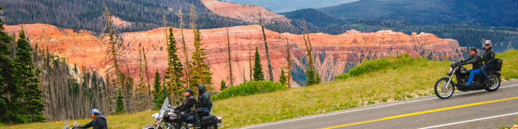
Brian Head - Panguitch Lake Scenic Byway
State Route Hwy 143 - Patchwork Parkway
This 50-mile journey begins in Parowan, located 19 miles north of Cedar City. The road then climbs through the Parowan Canyon past the stunning Vermillion Cliffs—named for the color produced by the iron oxides in the rock—and then passes the White Cliffs before entering the Dixie National Forest. From here, you’ll continue to climb up a steep grade all the way to Brian Head at 9,800 feet, the highest city in Utah (also home to the state’s highest ski resort). From this elevation at the top of the Markagunt Plateau, you’ll have vistas that span 100 miles every way you look.
About 15 miles from Parowan you’ll reach the junction with State Route 14: Take this through the Cedar Breaks National Monument to connect with State Route 14 on the other side, on which you can continue west to Cedar City. Or after the junction with State Route 14 you could keep on driving down 143—from lush aspen forests to ancient lava fields to alpine lakes, the road certainly has a lot to offer.
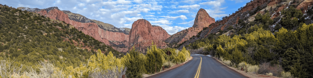
Kolob Canyons, North Zion National Park
Kolob Fingers Road
Kolob Canyons is a less commonly visited area of Zion, but the scenic Kolob Fingers Road is one of the highlights of the park. Find the Kolob Canyon Visitor Center at exit 40 on I-15, just 17 miles south of Cedar City. After making a stop at the visitor center, continue down Kolob Fingers Road, which is five miles each way and climbs 1,000 feet through beautiful crimson canyons to the Kolob Canyons Viewpoint, a picnic area with an epic perspective on the surrounding landscape.
National Park Tour
Visiting Utah's Mighty Five™
If you’re planning a tour of Utah’s national parks, you’re in for a fair amount of driving over a few days. So why not make the most of it and take the scenic journey between your destinations? Sure, it will add a little bit of time—but it will add a lot of picture-perfect memories.
From Cedar City, one of the best ways to string a lot of national parks together with scenic byways is to take State Route 14 to State Route 148 to State Route 143 (all described above) to your first destination: Bryce Canyon National Park (about 1.5 hours driving time).
Then take State Route 12 through the Grand Staircase-Escalante, one of the most breathtaking roads in the state (nicknamed “A Journey Through Time Scenic Byway”) to Capitol Reef National Park (about 2.5 hours driving time).
Next stop is Arches National Park, via State Route 24 through the San Rafael Swell (about 2 hours driving time), and finally on to Canyonlands National Park, only 30 minutes farther by State Route 313.
Download a map of Southern Utah and Nearby Attractions
Written By Samantha Larson via Roots Rated